Why Consider Drainage Mapping?
Drain mapping is an essential part of responsible site management and planning. It provides a clear picture of your underground drainage network — showing the location, size, and depth of each pipe — making it a valuable tool across a wide range of industries.
Accurate mapping supports effective pollution prevention and flood risk management. By knowing exactly how your drains connect, you can plan rapid and targeted responses in the event of a chemical spill, fire, or emergency.
For many commercial and industrial sites — including those regulated under COMAH (Control of Major Accident Hazards) and EPR (Environmental Permitting Regulations) — a compliant drain map is a legal requirement. We can help ensure your mapping meets all necessary standards and regulations.
Drain mapping is also crucial before any construction or excavation work begins. Understanding the existing drainage layout prevents accidental damage to underground systems — saving time, avoiding costly repairs, and keeping your project on schedule.
What Is Drain Mapping?
Drain mapping — sometimes referred to as asset mapping or a drainage layout plan — is the process of using advanced GPS and inspection technology to accurately record the position and details of your drainage system.
At Drain Pro North West, we combine innovative digital tools with extensive industry experience to pinpoint the exact location of every pipe, manhole, and gully on your site. The result is a custom, high-accuracy drainage plan that clearly shows how your underground network is connected.
Our surveys can also determine the size, depth, and direction of flow for each pipe, helping to distinguish between surface water and foul drainage systems. This detailed insight supports everything from construction planning to compliance documentation and ongoing maintenance.
How Does Drain Mapping Work?
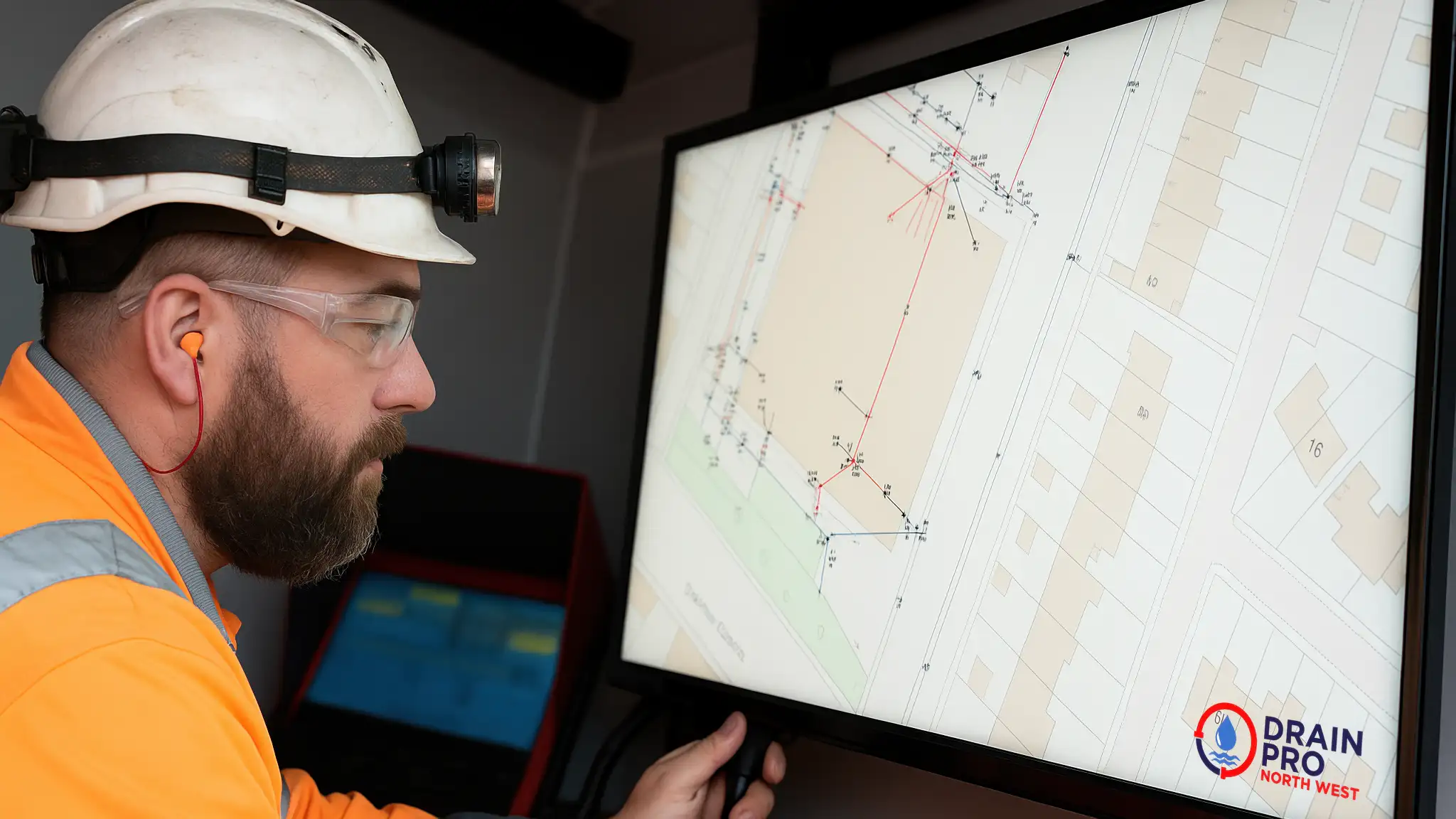
At Drain Pro North West, we combine expert knowledge with the latest technology to deliver precise, professional drain mapping surveys. Using high-accuracy GPS equipment, we capture location data within 2cm precision, ensuring every pipe, manhole, and connection is recorded exactly where it should be.
Our system works with OSGM15 coordinate data, allowing us to produce maps that integrate seamlessly with national mapping standards. Once all site data has been collected, we generate a comprehensive digital report tailored to your requirements — clearly displaying your drainage layout, flow directions, and asset details.
While on site, our experienced engineers work efficiently and safely, keeping disruption to a minimum. We take pride in delivering accurate results, professional communication, and exceptional service from start to finish.
What Does the Drain Mapping Report Include?
Every drain mapping survey we carry out produces a detailed, easy-to-understand drainage layout plan, tailored to your specific site requirements.
Your report typically includes:
-
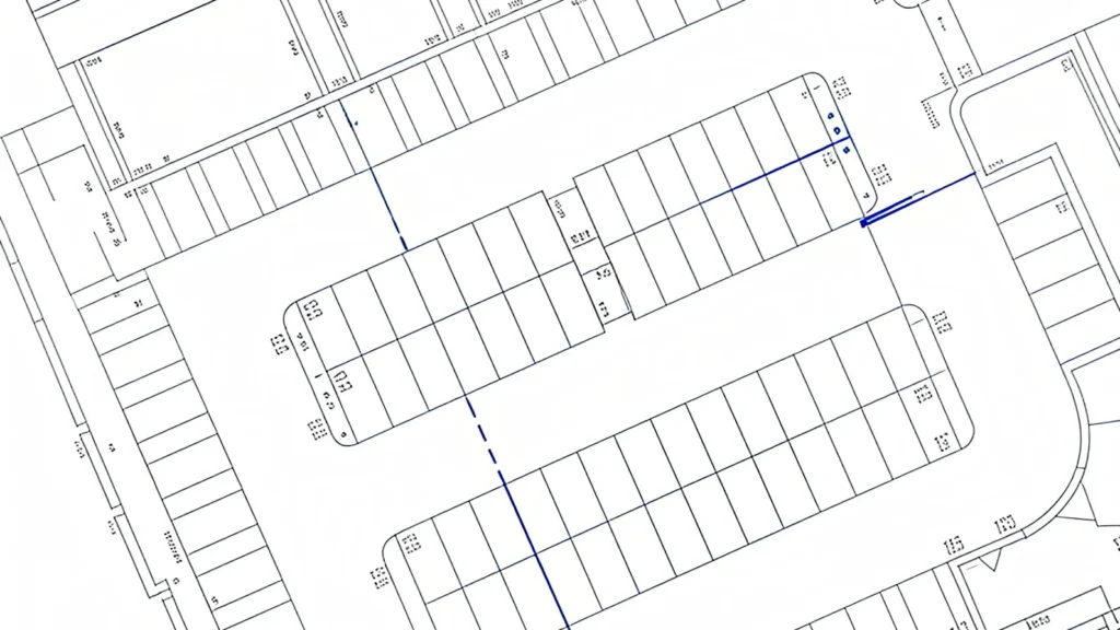
Comprehensive site map – a clear schematic drawing showing the complete layout of your drainage network.
-
Asset register – listing the size, depth, location, and function of every drain section, along with all manhole and access points.
-
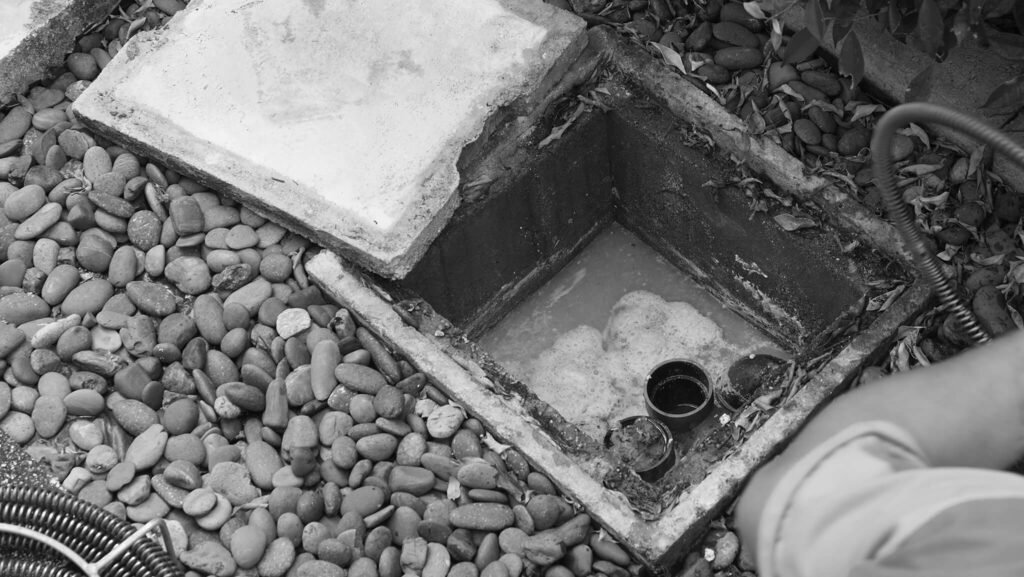
Manhole record cards – featuring photographs and key information for each chamber or inspection point.
-
Interactive Google Maps overlay – allowing you to click on individual drain sections to view detailed data, photographs, and asset information.
If required, we can also provide a DXF file compatible with your existing CAD system, complete with OS tile background mapping for full spatial accuracy.
Beyond drainage networks, we can design custom data collection forms to record and map other above-ground features — such as streetlights, signage, benches, or utilities — giving you a complete picture of your site assets.
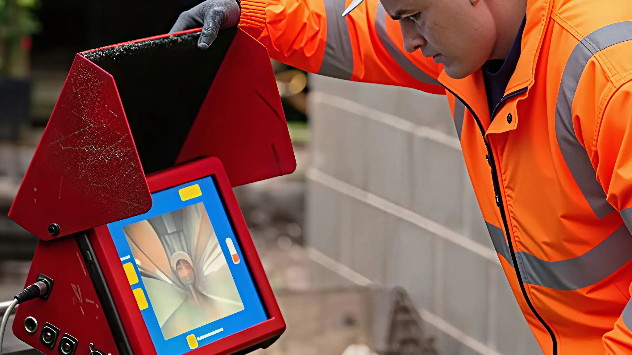
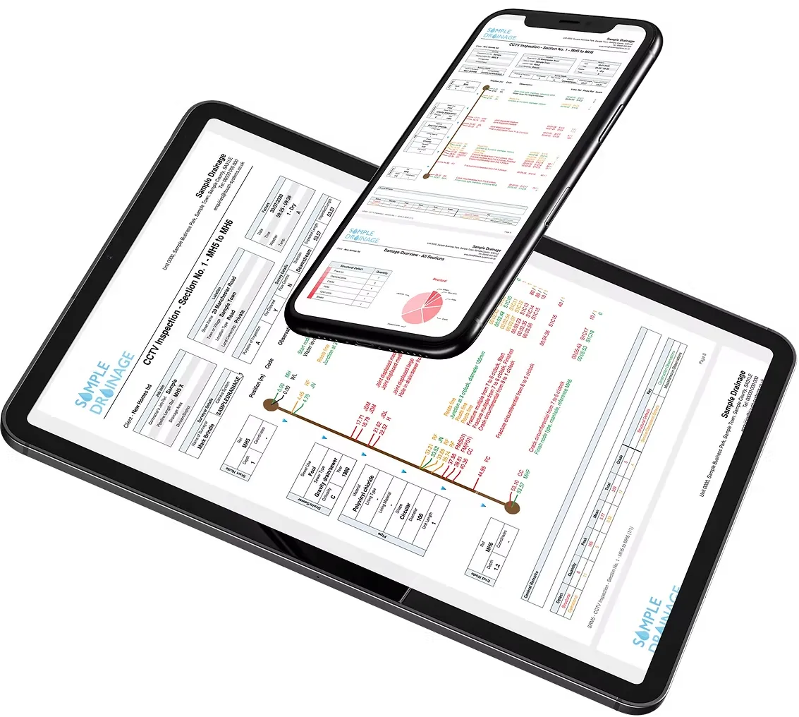
Customers can access their full CCTV inspection report & video footage wherever you are, on any device with internet access via your secure iTouch Live log in.
Experts in Drain and Asset Mapping
At Drain Pro North West, we’re specialists in drain and asset mapping for commercial, industrial, and residential sites. Our experienced engineers combine technical expertise with a practical understanding of on-site requirements, ensuring every survey is accurate, compliant, and tailored to your needs.
We know how important it is to have a clear, up-to-date map of your drainage system — whether for compliance, safety planning, or construction. That’s why our service is built around precision, transparency, and customer care from start to finish.
To discuss your drain mapping requirements or arrange a free, no-obligation site visit, contact our friendly team today. We’ll be happy to provide expert advice and a detailed quote for your project.
Fast, Accurate Reporting with iTouch Live Technology
When our operator arrives on site, your survey begins immediately. As the CCTV inspection is carried out, the data is captured and processed in real time using our iTouch One system. The footage and findings are automatically streamed to our office via iTouch Live, where they’re reviewed and validated by our technical team.
This seamless workflow means your report is often progressing through quality assurance before our engineer even leaves site — allowing us to deliver exceptionally fast results without compromising accuracy.
Using advanced iTouch technology, we can identify and code structural defects, service conditions, construction features, and other key details to the highest industry standards. The result is a comprehensive CCTV inspection and mapping report, professionally formatted and delivered digitally for instant access.
Book Your Drain Mapping Survey Today
Get fast, accurate, and fully compliant drain mapping from the North West’s trusted drainage experts.
Contact our team today to arrange your free, no-obligation quote — or book a site visit at a time that suits you.